3D Profiling
Background
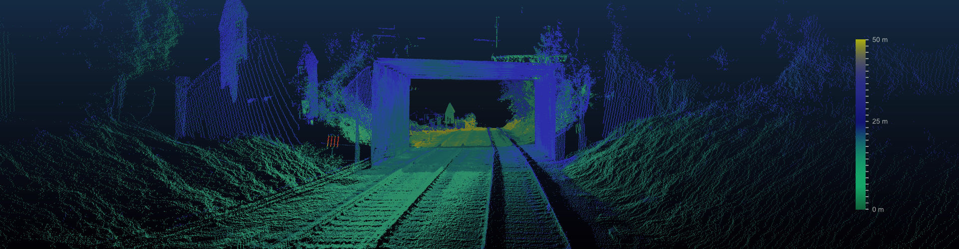
3D Track profiling generates a 360 degrees three dimensional map of railway track with details of track objects and their relative differences. This requires a combination of optical imaging and point cloud data collection using LIDAR, and the fusing the two to create a three dimensional map of the scene. The 3D map serves multiple purposes. First, it may be used for repairs and renewals. Engineers can use such data in an office environment to plan their physical engineering activities on-site in advance of any visits. Interactive software and maps allow engineers to make their own measurements by zooming, rotating and manipulating the scene as needed. Second, 3D profiling serves the basis of various clearance measurements that ensures that all rolling stock can pass through the surveyed area without any obstructions, vegetation does not interfere with vehicle moving envelope and for ensuring that signalling and civil components are placed correctly with respect to track centre-line. Third, the map can be used to generate a virtual environment for training of train drivers. Finally, regular surveys generate data that can be compared over time, showing changes in assets and their condition.
A 3D profile data set on its own is of limited use. Object identity must be tied with its measurements and 2D colour image data and 3D point cloud data must be synchronised so that we can see objects with their 3D surface properties and visual appearance with colour image data. Additionally, it is very important for end-users to have a suite of tools to make interactive measurements as needed on all data collected. 3D profiling is extensively used in Railways for clearance measurements and for mapping the track areas in order to guide renewals and repairs and for auditing construction work performed on rail tracks.
RV Diagnostics
TrackVue S series sensing is designed to mimic the driver’s view, imaging from the front (ideal) or the back of the vehicle at high speeds. Colour imaging sensors, combined with two and three dimensional LIDAR sensors provide detailed information on assets, their condition, track and tunnel clearances, weeds and vegetation issues, and risk from poor sighting distances of level crossings, speed signs and signals. Three dimensional laser point cloud data can be used with automated identification of assets and their condition to produce 3D animated models of the track.
S series uses high resolution colour cameras combined with 2D/3D lidar sensors to acquire very high quality front and side data of the track from a high speed moving vehicle. The data is analysed in real-time for recognising assets, evaluating their condition and making depth based measurements. The classification and labelling of assets is based on their visual properties (dimension, colour, texture, shape, 3D surface profile). The data for each asset is recorded for their track position.
RV Advantage
- The system can combine 3D track profile data with track geometry data to correct for clearance measurements. The ability to do both measurements synchronously provides a strong advantage especially for clearance measurements.
- Our 3D data has indexed objects that have been identified by 2D colour image analytics
- We provide interactive software for users to make manual measurements from 3D data
.