Sighting Distances
Background
The measurement of sighting distances is very important to measure the risk of overrunning a signal or level crossing at high speed. Each railroad sets minimum sighting distances for signals, level crossings, speed signs and so on to meet regulations. The sighting distances of these assets by train drivers may change over time because of vegetation growth, newly constructed civil structures, and landscape changes that obstruct a clear view. The problem is further exacerbated on curved track. Regular physical surveys to assess sighting risks are time consuming, reduce track capacity, and carry significant cost. S series equipment is designed to recognise these assets automatically, and track these structures over image data to find the first and last instances of their presence in images, calculating sighting distances in meters.
RV Diagnostics
TrackVue S Series equipment uses a combination of colour camera analytics, encoder data, and AI for automated calculation of sighting distances of key track assets including signals, level crossings and speed signs. This provides a compliance database from where any assets not visible from a minimal sighting position can be highlighted. The following table shows the measurements made.
| Sighting Measurements | |
|---|---|
| Signal sighting | Signal ID, track position, sighting distances in meter, risk index |
| Level crossing sighting | Level crossing ID, track position, sighting distances in meter, risk index |
| Speed sign sighting | Speed sign ID, track position, sighting distances in meter, risk index |
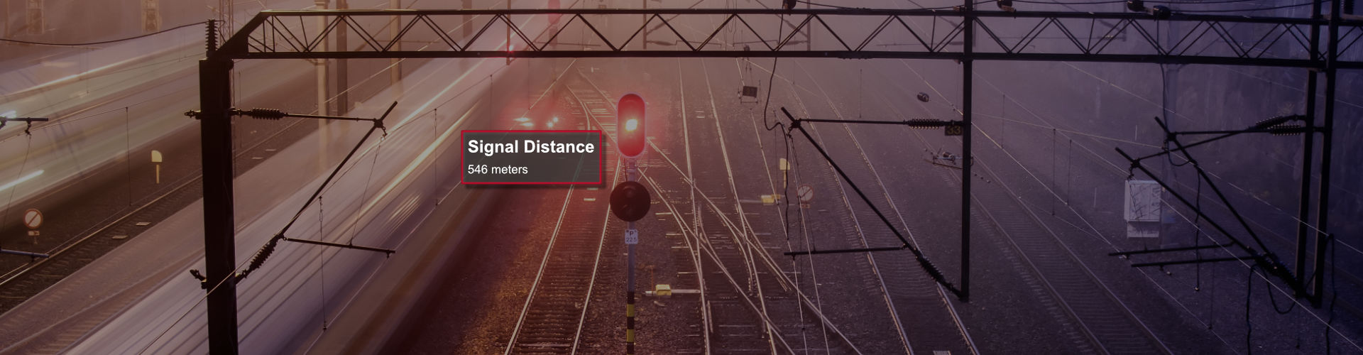
The following picture shows the sighting distance calculated for a signal. Given that all images are uniformly spaced by a distance of one meter, the sighting distances are accurate up to one meter in accuracy.
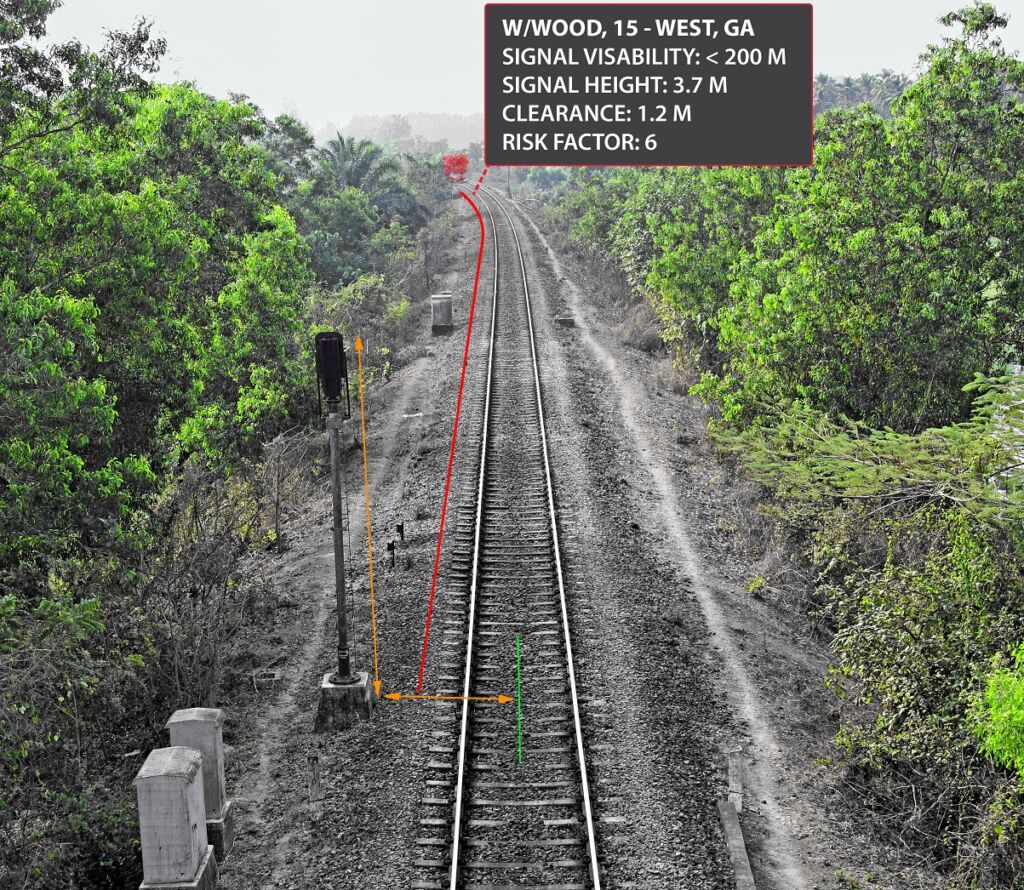
TrackVue S series equipment uses forward facing high resolution imagery trigged by a wheel encoder signal for uniform spacing of data. The positioning of the equipment mimics how a train operator would see a track asset, e.g. signal, speed sign, level crossing, tunnel, bridge etc. Sighting distances are important to prepare for braking where needed. In poor visibility conditions which may result from either the object covered by vegetation of other obstructions, or because of fog or poor lighting, late braking may result in an accident. Our equipment automatically recognises an asset through AI based image analytics, and tracks it in successive images to determine when the object is in the same plane as the sensor. The sighting distance is calculated in meters based on images covered between these start and end positions. The data for each Asset is recorded in a database including their ID, chainage, GPS and sighting distance. Exception reports are generated to highlight Assets that do not meet government approved minimal sighting requirements which may then trigger maintenance actions.
RV Advantage
TrackVue S series equipment for sighting distances has the following unique advantages.
- The equipment is completely mounted outside the train. It does not interfere with the driver view, there is no driver in-cabin equipment.
- The measurement system is a part of a larger integrated unit responsible for 3D track surveying and vegetation detection. This allows for sighting data to be correlated with vegetation interference data.
- The system is accurate up to 2 meters and mimics human visual response to detection of assets.
- The system has inertial sensors that generate track curvature information that is correlated with each sighting distance data point.