Aerial View
Background
Drone technology is increasingly being used for surveying, load carrying, deliveries, military and other applications. The application of advanced vision sensors on drones and data collection is an established practice. With the advent of automated machine learning based vision analytics, they will play a major role in infrastructure monitoring within railways.
The use of drones will have a major application in railways of the future. With the reduced availability of manual labour able to inspect long sections of rail track, and difficulties in reaching assets that are high, dangerous or difficult to access (e.g. overhead lines, bridges), coupled with the inability for train-borne equipment to inspect these areas, drones of the future will work alongside train-borne inspection systems for a comprehensive assessment of all relevant assets and their conditions.
Currently, the growth of such systems in railways is limited because of regulations on where drones are allowed, and technological limitations with drone operations beyond line of sight. The current use of drones is limited to survey systems that are operated manually for specific fixed surveys, e.g. inspection a section of the bridge, or for mapping railway lines and their surrounding areas, e.g. capture drone video footage for post-processing.
The future use of drone will focus on operations beyond line of right. Automated data analytics will replace human labour to a large extent for regular basic visual inspection that is carried out everyday manually. Drone based image analytics solutions will not replace train borne imaging completely but complement it, with the following analytics.
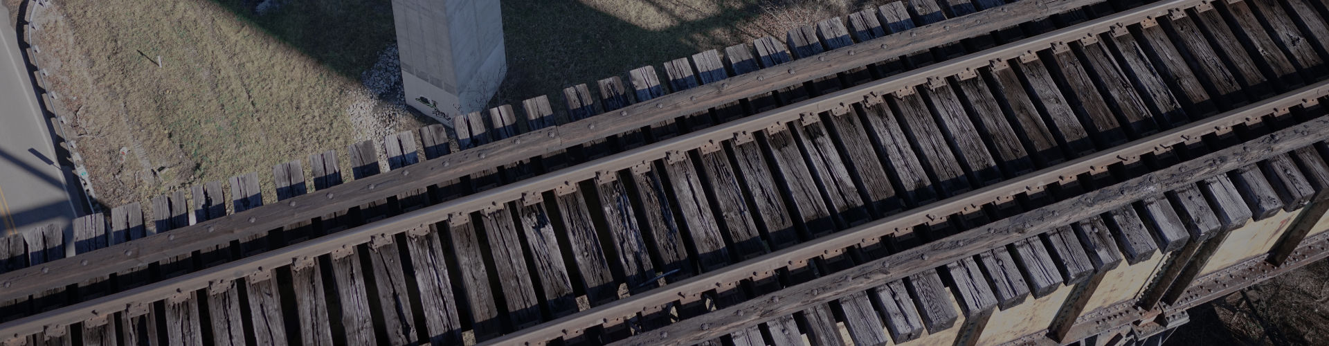
Drone based visual inspection of railway tracks
- Any safety related checks which may derail the trains, e.g. physical separation, crack, faulty joints, missing fishplates, any kink or misalignment or a dip in the track, and vigilance related inspections;
- Subsidence issues where the track level is affected, mudspots or ballast/track movement, overflowing of water, stagnation of water near the track, endangering safety is to be seen.
- Inspection of points and crossings, switch expansion joints, glued joints to be seen and abnormalities to be seen and reported.
- Track infringement checks, boulders, stones, other similar obstructions on the track or near the track causing infringement on the track; cattle carcass found on the track;
Drone based solutions will become intelligent over time and their autonomous operations will interface with maintenance activities. Several hundred drones may be employed, each covered a fixed section, able to work autonomously beyond line of sight, and sending live real-time critical defect data for train safety.
RV Diagnostics
Rail Vision is in the early stages of developing drone based technology for railways following its detailed experience in the use of drones for agriculture. Our current capability extends to post-processing of drone based footage to automatically diagnose asset condition for bridges. The following images show a 30 megapixel image data collection of bridges on which automated data analytics is used to identify areas of interest and potential defect.
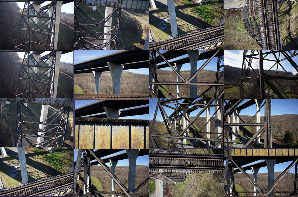
Our diagnostic solutions are present focus on the use of existing drones for data collection, followed by identification of key asset and landmarks, and then using pixel data to make accurate 2D measurements on surface and using range data for depth based measurements. The image on the left shows various sections of the bridge under examination. The data is collected and processed offline. We are also at present limited to day time operations that are controlled by a human operator. We are working on future innovation to develop autonomous drones that can work Beyond Line of Sight (BLOS). We are also working on AI chips and embedded AI to develop compact low cost on-board processing solutions for real-time analytics and cloud transfer.
RV Advantage
The main advantages of Rail Vision systems include:
- Automated image analytics with no manual intervention for processing drone footage for postprocessing data analysis
- Future drone equipment will combine a multitude of sensors for contextual awareness and data collection
- A complete real-time data analytics solution combined with cloud capability